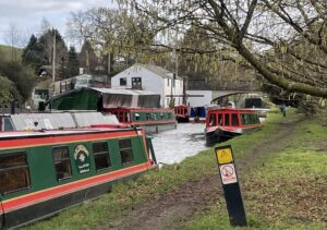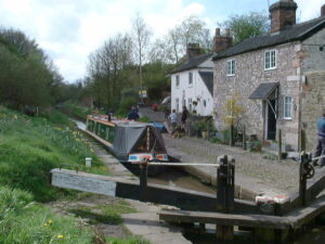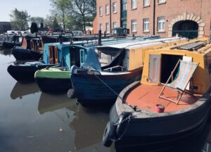
We’ve jumped ship!

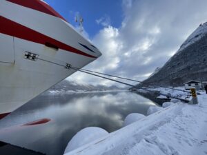
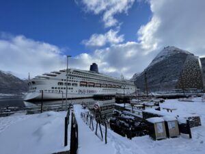
P & O Aurora docked at Andalsnes, Norway


Last week we abandoned our narrowboat in a marina and headed for a bigger boat and more turbulent waters. We sailed on this ship 4 years ago, P & O’s Aurora, doing a return cruise from Southampton up the Norwegian coast to Alta, in search of the Northern Lights (and Trolls 😀).

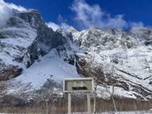
Beware the trolls
The Troll wall, Rauma Valley


We’re repeating the cruise for two reasons, the first is to hopefully give Ian’s mum the chance to fulfil a lifetime’s ambition to see the Aurora Borealis, the second is for Ian to enjoy it this time, as last time he was rather poorly and spent half of the cruise in the cabin.
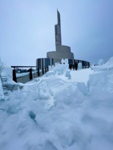
The Northern Lights Cathedral, Alta, Norway (with ice sculptures)

Currently, we are docked at Alta, Norway, our furthest northern port. Alta is 248 miles (400km) above the Arctic circle but is still 1,380mi (2,221km) south of the North Pole. It’s one of the best locations for seeing the Northern Lights. Unfortunately, the weather has turned rather blizzard-like. A local guide told Ian that this is some of the worst weather they have had here this year. Just our luck – we were supposed to be travelling to a remote camp to view the Northern Lights tonight, but the road up there is blocked, so our evening trip has been cancelled.
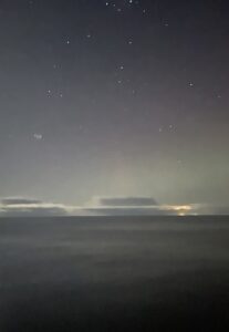

The Lights may appear as pale whiteish “clouds” 
A digital or phone camera will show the true colours

It’s always been a game of luck. For the best chance of seeing the lights, you need a high KP (measure of solar activity scaled 0-9) and a clear sky with the absence of either daylight or light pollution. The Kp-Index – derived from the German “Planetarische Kennziffer meaning “Planetary Index” – is a measure of geomagnetic activity in the Earth’s atmosphere. The colourful glow of the Aurora (also known as the aurora borealis or polar lights) is the result of particles from the sun releasing energy as they bombard the gases in the Earth’s atmosphere. When particles collide with oxygen, the aurora produces green and yellow, with nitrogen, you’ll see red, violet and occasionally blue. The red colour has historically been seen as a terrifying portent of war and bloodshed, a dramatic display appeared over the UK just before the French revolution in 1789.
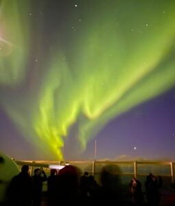
A dramatic display out at sea


The northern lights weren’t called Aurora Borealis until 1621 when Galileo Gallilei named them, Aurōra is Latin for dawn and Boreas is Greek for the north wind.
There are many different legends about the Aurora Borealis.
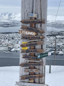
On top of Storsteinen above Tromso

The indigenous population of the Nordic countries are the Sami people, one of their names for the lights is Guovssahas, meaning the hearable light. They believe that the Aurora carries the sounds of their dead ancestors. In respect of this, you should never whistle or
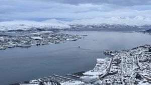
Tromso- starting point for North Pole expeditions

sing during a display, as you risk being whisked away by the lights, never to be seen again (apparently you can clap your hands to ward them off). The Sami also believe that a child conceived under the Northern Lights is blessed with both good fortune and looks. Ironically, a tradition of North American Indians is to whistle at the lights to draw them closer so that they will take a whispered message back to a loved one.

The sky bridge of light

Norse mythology, believes that the Aurora is the Bifrost, the sky bridge between Åsgard (the land of gods) and Midgard (the land of humanity). Other stories suggest that the light is reflected from the shields of the Valkyrie, the female angels of death sent to retrieve fallen Viking warriors and lead them to Valhalla, Odin’s majestic hall in Åsgard.


Finally, in northern Sweden, it was believed that huge shoals of herring swimming in the northern seas created a spectacular show and promised a bountiful catch; so when the Aurora was up, it was time to get the nets out and go fishing.

Happy people

The flip side of our cancelled trip, the cost has now been refunded! So, it’s time for us to head off to check out the wine list!!! The blizzard is due to stop later with clearing skies and a potential KP of 4, so we might still get a peak at the Aurora later tonight. 
The Mammoth Tower

Views obscured by trees and hedges

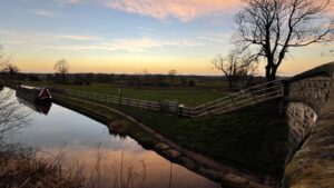
The canals often form long green corridors which are screened from the surrounding countryside by hedges and trees, so you don’t always realise what you’re going past. As we headed up the Llangollen a few weeks ago, we spotted a sign for the Mammoth Tower and decided to stop on our way back.

We had no idea what we’d been cruising through or on for that matter! We’ve cruised this way several times and never bothered to stop. We knew the land was flat and the canal was straight and raised up, it seemed a bit boring. We had no idea what was going on or how wrong we were.
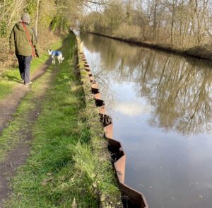
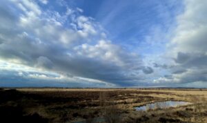
For starters, we discovered that the canal was actually built on a raft that allows it to “float“ across the peatbog, an area which stretches over 2,300 acres. This boggy peat land caused a massive headache for the canal engineers (Telford and Jessop) when they were constructing the canal. So instead of the expense in time and money of going around it, they decided to float the canal over it.


In the early 1800s, they lowered the water table of the Whixall and Bettisfield Mosses by creating big ditches and draining the land, then they formed the raft for the canal to be built on. As this would be prone to collapsing, a team of navvies (navigation workers) were employed to continuously monitor and reinforce the banking around the floating canal. These navvies became known as the Whixall Moss Gang and their worked continued for nearly 160 years, from 1804 until 1960, the Gang became the longest serving group of navvies on British canals. In the 1960s this floating section was underpinned with sheets of steel piling to stop it from collapsing. Two breaches have occurred, but on both occasions, these have been attributed to the weakening of the bank by burrowing animals, mainly badgers.

Mammoth Viewing Tower

When we eventually reached the Mammoth Tower we discovered that it was a viewing platform on the edge of a huge National Nature Reserve overlooking the Mosses. Natural England are in the process of raising the water levels to allow the peatland to regenerate as a raised peat bog, a bit like allowing a dry sponge to soak up water. The peat that remains has tell-tale signs that indicate how the peat was extracted for over 500 years. Originally cut by hand under the license of the Lord of the Manor, it was used for fuel, distillation, animal bedding and packing. Then during the 1920s the extraction rate was increased, and larger quantities were used for agricultural fertiliser and garden compost. The cutting became mechanised in the late 1960s and by the late 1989 the rate had quadrupled causing a public outcry. The resulting campaign led to the central area of the Mosses being declared a Natural Nature Reserve in 1990.

Pools remain where peat was cut by hand

Evidence of peat cutting remains on the Mosses as does the old narrow-gauge tramway that used to transport the harvested peat to the derelict Old Fenn’s Peat Factory. The Military have also left their mark on this land. During World War I there were over 20,000 troops in Camps around the area; large rifle ranges were set up for training Kitchener’s New Army and this included an onsite base camp for 1,000 soldiers. During World War II, a bombing range was added for the local flying schools and it was also set up as a secret Strategic Starfish site. The Starfish sites were created during the Blitz and were large configurations of multiple fire baskets, lit at night to simulate nearby towns or cities, acting as a decoy to night time enemy bombers.

View through the periscope

I think we were both surprised and a little shocked by what we learnt as we wandered along the nature trails and read the signs. Ending up back at the Mammoth Tower we had an amazing vantage point to view the landscape. Even at the end of winter, the Mosses have a remote and rare beauty that simply takes your breath away. Whilst mammoths roamed here during last ice age, and past human activity has left its scars, this peatland is now quiet and home to a wealth of life.

Going back in time

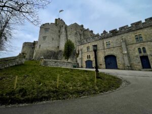
Walking up to Chirk Castle

We have turned around and headed to Chirk Castle where we have finally decided to join the National Trust! (There’s a slight ulterior motive, it means we won’t have to pay to use their car parks with the motorhome when we head to Cornwall in May!) But it’s made me feel very grown up and responsible!!

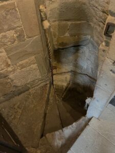
Steps down to the dungeons

I’m not sure what either of us were expecting from this castle, we’ve gone past the signs for it numerous times either on the road or on canal. I certainly hadn’t anticipated seeing a complete castle that is still lived in today. As you walk around it you see a history spanning over 800 years. It was originally built in 1295 by an English Marcher Lord Robert Mortimer who was granted the Lordship of Chirklands by King Edward I. It was built as a defensive medieval fortress along the Welsh-English border and was an important part of the king’s efforts to keep the Welsh under English rule. In 1595 it became a family home to the Myddeltons until ownership was transferred to the National Trust in 1981. There were some very worn stone steps and dark corners so I did ask one of the volunteers if there were any ghosts. Apparently not, just some “atmospheric” corners!

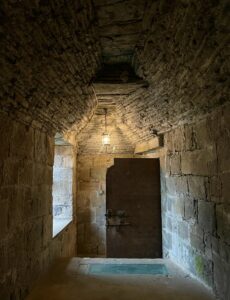
Upper corridor in Adam’s Tower, Chirk Castle
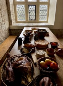
Medieval fare in Adam’s Tower


There are interiors and artefacts from just about every period of English history including the civil war. It’s a fascinating place to visit and is set in extensive gardens and grounds. It was a chilly day, so the café was the busiest section, but the food was great. The medieval dungeons and Adam’s Tower were well worth a visit and made a huge contrast to the parts of the castle that were lived in and decorated during the last 400 years!

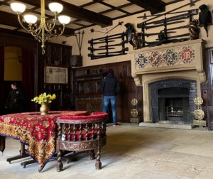
Cromwell Hall, (artefacts from the civil war) Chirk Castle 

Back on the boat it turns out I’d asked the wrong person about the ghosts! Chirk is said to be haunted by a lady dressed in green, a dog, crying children, and soldiers carrying an injured comrade on a stretcher. And, there are even reports of tiny invisible hands, grabbing at unexpecting passers-by who dare to walk the corridors of Castle Chirk. I’m relieved to have escaped without those experiences!

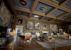
The saloon at Chirk Castle

Back on the canal and we continued downstream through yet another tunnel and we stayed for a few days beside Blake Mere. This is a favourite spot for us as the mere (lake) is within a sticks throw of the canal. It’s quite stunning with lots of ducks, swans and anglers!

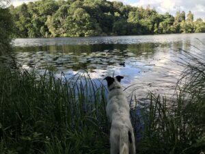
Blake Mere in the summertime (Sammy duck spotting)

Heading for the heights!


I honestly thought we’d never make it to Llangollen, what with the winter stoppages and my knee operation. It’s taken a long time, but we made it! This blog is rather full of photos, it’s the only way to do it justice, after all, some of it is designated as a UNESCO World Heritage Site.

Horseshoe Falls at Llantysilio

Some of this canal was never meant to be a canal, it’s shallow, gets very narrow in parts. Unlike most canals it has a flow with very big by-washes around the locks. The top section of the Llangollen Canal was originally built as a feeder to supply water to both the canal and to the towns and industries of north Shropshire and Cheshire. The water is diverted from the River Dee at Horseshoe Falls, Llantysilio and flows down the 46 miles of the Llangollen Canal to the reservoir at Hurleston.

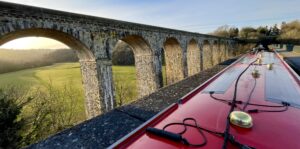
Going over Chirk Aqueduct with the railway viaduct alongside

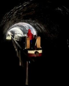
For a water conduit it is spectacular. 46 miles long with 21 locks, but it boasts two sensational aqueducts and three tunnels. Chirk Tunnel is the second ever to be built with a tow path. Most of the canal tunnels in the UK don’t have them, so the crews of the original horse-drawn boats had to lie on boards across their boats and “leg-it” through,  the horses were led over the hill to be re-hitched at the other end. Walking the 1,381ft, 420 metres of Chirk tunnel takes some courage as it is extremely dark inside with spiders and slimy walls. Of course, Ian walked it barefoot, twice. And claims he never saw any spiders.

Inside Chirk Tunnel

One tunnel visitor described seeing a narrowboat pass her in the tunnel, when she wished the boater a “Good morning!” they dropped their mug of coffee in shock. She was only a few feet away, but the boater couldn’t see her. If you’re feeling brave and decide to walk through it, then please follow the advice and wear a headtorch!

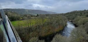
Looking down from the edge of the Pontcysyllte Aqueduct 

The constant flow of water is a problem for boaters going upstream. The tunnels and aqueducts are very narrow and shallow, boats struggle against the flow. With such small channels the displaced water causes the boat to be sucked down and makes it difficult to make progress. This is particularly true as you go over the very narrow Chirk and Pontcysyllte aqueducts, which is fine if you don’t get vertigo. Chirk Aqueduct is 70ft (21 m) high and the Pontcysyllte is 126 ft (38 m) high (believe me it looks a lot higher from the back of the boat!). Both are amazing feats of engineering and must be experienced first-hand to truly be appreciated.

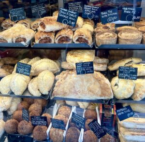
Oggies the size of dinner plates
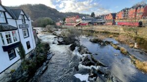
River Dee passes through Llangollen

Llangollen town has been a popular tourist destination since Victorian times. It is very pretty and full of interesting shops and cafes, the bakers sell Oggies (huge pasties) and the weirdest versions of scotch eggs ever (Blackwatch made with black pudding).

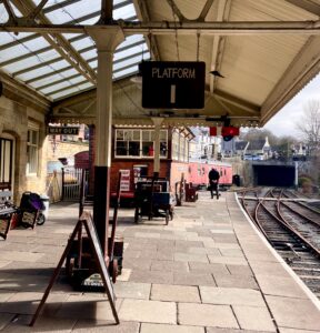
Platform 1 at Llangollen
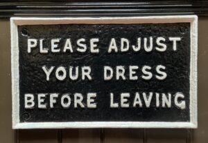
Sign by the Ladies toilets!!


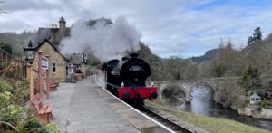
The railway station is an absolute delight and runs steam trains and diesel engines to Carrog passing along stunning valleys of the River Dee. https://llangollen-railway.co.uk. In it’s heyday, the line linked to the main line and went all the way to Barmouth, on the coast. 

We rode the steam train up to Berwyn and walked on to Horseshoe Falls before following the feeder canal back downstream to the canal basin. This top section is kept shallow so that only the horse-drawn trip boats can make passage up to the Chainbridge Hotel. The river is quite dramatic up here and a favourite of kayakers, they have a steep slate slide to launch themselves down the bank and into the river, great fun to watch!

Its a steep walk up to the castle

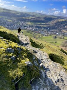
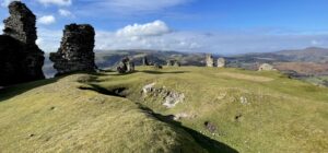
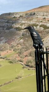
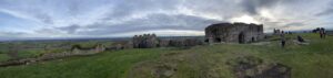
On previous trips to Llangollen, we’ve admired the ruins of the local medieval castle from below, but this time we were blessed with the perfect weather and headed up for a closer look. Castell Dinas Bran, known locally as Crow Castle, dominates the skyline. Occupation of the hill dates back to the iron age, around 600BC, but the remaining romantic arches that frame the landscape are from around the 13th century.

The remains of Castell Dinas Bran-Crow Castle

The views are incredible and well worth the climb. In the Victorian period, the local people used to set up a teashop at the top and there was even a camera obscura to admire the view. Today we had to rely on our own cameras and making a well-earned brew back on the boat.

View Offa’s Dyke from gate on Crow Castle

Shush – It’s a secret!

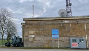
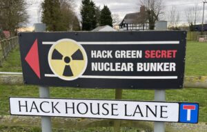
If you thought nuclear bunkers are supposed to be secret, don’t visit south west Cheshire. There are signs to one all over the place, even next to the canal. If you want to know, it’s about 5 minutes walk west from bridge 85 of the Shropshire Union Canal. It’s on Google Maps too.

Growing up in the (showing our age) 70s and 80s, we were part of the generation who knew what it was like to live under the shadow of the Cold War and the threat of a nuclear attack. I vividly remember my Physics teacher describing what we should do if we had the four-minute warning.

Dial calculator for estimating damage from ground zero
Government campaign to educate civilians

He even gave us a paper dial calculator to estimate damage and rate of survival depending on how close we were to ground zero. I also remember watching the Government’s Protect and Survive film from 1976 and the rather devastating comic book and film from the 1980s by Raymond Briggs of “When the Wind Blows” (I had nightmares for years).

This is perhaps why I’ve had a morbid fascination to find out where the secret nuclear bunkers were and what it would be like to be in one. Allegedly, there are over 200 war bunkers spread randomly across the UK, some of which you can now visit as museums including Westminster, Liverpool, Fife, Hull and Brentwood. There’s even an underground city in Wiltshire, codenamed Burlington, it was built to house 4,000 people, it had its own subterranean lake, railway station and hospital.

Like many of the war bunkers, Hack Green was decommissioned in 1991 after the Cold War ended and was later declassified in 2004. This one became a museum, but some have been sold as residential properties and one has even become a wine store. The Hope Cove Bunker, near Salcombe in Devon, is very similar to Hack Green both in style and history. It was sold for £433,000 in 2021. If you’re interested in owning a smaller observation bunker, there were over a thousand built and one was  recently on the market for around £25,000. Access is down a 14ft (4m) vertical shaft, so it’s not for the faint hearted.


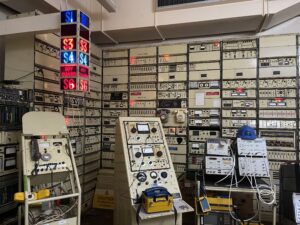
The Hack Green Nuclear Bunker was first operated in 1941 as a Ground Controlled Radar Station & Flight Control. At the end of WWII, it continued as an RAF Standby Radar Station. When I saw the signals room, it reminded me that my Dad served as a radio engineer in the RAF for his National Service. He probably worked on similar equipment, although he was based in the south of England.
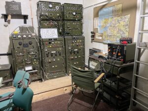
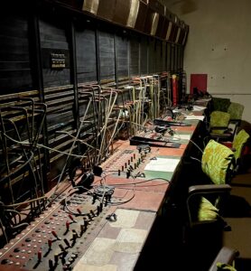

 

Signals Room c1950s
Main switch boar


It wasn’t until a rebuild in 1979 that Hack Green became one of the Regional Government Defence Headquarters. At a cost of £32 million, approximately £140 million in today’s value, it was upgraded to withstand a nuclear attack for up to 12 weeks, housing 135 civil servants and military personnel.


What was most poignant for me, was seeing the letters and handwritten messages that have been stuck to the upstairs corridor. These showed that the locals didn’t know that the bunker existed and also how scared parents were for their children’s future. It was quite shocking to watch a banned BBC film which plays in a downstairs theatre and is a re-enactment of how people in a town face the reality of a nuclear strike.
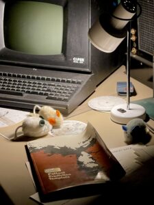
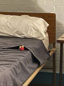
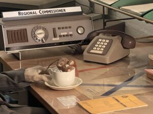
Spot the Spy Mice

We never took our children around this museum, but if they had gone, the charity that runs this Bunker have hidden toy “Spy Mice” throughout the displays which would have created a little distraction for them. Walking through the exhibitions and watching the films is a stark reminder of how fragile our world is. I’m certainly grateful that the Cold War is over and I do hope that it stays that way.

From Beeston to Pluto

Beeston Castle from the Shropshire Union Canal

We’ve taken a little detour so that Ian could climb up the nearest hill!
This time we had to negotiate the Bunbury staircase and scoot past Chas Hardern Boat Yard, once the terminus of the Chester Canal (previous name for this stretch of the “Shroppie”).

Chas Hardern Boat Yard near to Tarporley and Beeston

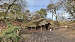
The hill, or rather the rocky sandstone crag, is the site of Beeston Castle, a rather imposing edifice that overlooks the Cheshire Plain. This distinctive landmark has been inhabited for over 4,000 years and boasts the remains of a medieval castle and a replica Bronze Age roundhouse. The replica roundhouse was built using Bronze Age tools and techniques and is modelled after the remains of seven roundhouses that were found by archeologists excavating between the Outer Bailey and Castle.
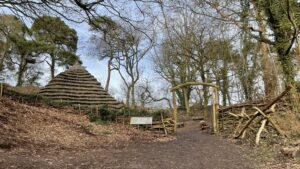
Entrance to replica Round House
Round House on Beeston Castle

It has a very long history including being an iron age fort, a prison for Welsh hostages in the 13th century and in the mid 1600s, it was besieged by both the Parliamentarians and the Royalists during the final years of the Civil War. The castle was originally built for Ranulf de Blondville, but eventually became a Royal castle when it passed into the ownership of King Henry III who gifted it to his son, Prince Edward. The views from the top are well worth the 350 ft (107m) climb and at the bottom is a rather nice café!

The Cheshire Plain viewed from Beeston Castle

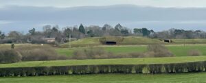
Within sight of the castle are some rather curious bumps that look like empty missile silos. They are reminiscent of the Greenham Common Air Base that we used to live near to, except they’re not! They are, however, part of a huge, decommissioned WWII Bulk Fuel Installation. Some of the tanks are open and exposed, but the pipes and support structures are still inside a few of them.

The exposed PLUTO tanks

Years ago, when we first saw these “caves”, I thought  they were disused armouries that were now being used to store wine or cheese. That was rubbish. They are on private land; the landowner keeps red deer in the fields around them and is very protective of his grounds (you have been warned!). The tanks were storage for imported oil and bulk fuel from the Stanlow Refinery at Ellesmere Port and were connected to PLUTO (Pipe Line Under The Ocean). These storage tanks were part of a chain that linked fuel stocks across the country and supplied fuel for the D Day Normandy Landings in 1944.


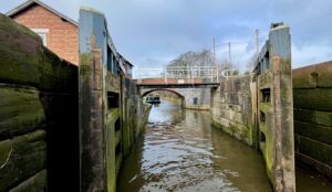
Looking out from the lower Bunbury Staircase Lock


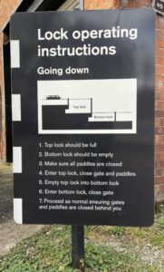
Although we’re less than 20 lock/miles from Chester, it is not our current destination, so we’ve turned around and headed back though the Bunbury Staircase. Two locks which are joined together, having three sets of gates and paddles. The height of the middle lock gates is quite intimidating, but thankfully there are footbridges, so you don’t have to walk across the gates to operate the lock! 

The contrast of the buildings and the history of this little area of Cheshire has been quite an eye opener and well worth the little detour.

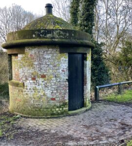
   Lock keepers huts, unique to the Chester Canal 1777
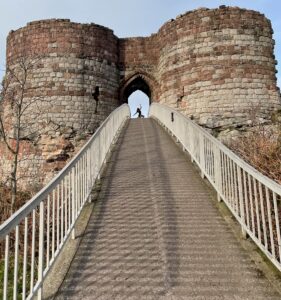
Footbridge (1980s) rising to Medieval Gateway of Beeston Castle 1220s

Maureen’s Lock and a tsunami

Passing a boat at bridge 14 on Middlewich Branch

We’re heading west and need to get to the Shropshire Union Canal. From here the only way west is the Middlewich Branch of the Shropshire Union.

Entrance to Wardle Canal

Originally planned in 1760 this canal branch wasn’t built until 1827. It’s 10 miles long with 3 deep locks (at least 3m) and stretches from Barbridge (north of Nantwich) to Middlewich, where it suddenly stops within sight of the Trent & Mersey Canal. An act of parliament prevented this canal from coming within a 100ft of the T & M. Any cargo for the Potteries or Liverpool had to be off loaded and reloaded onto the waiting barges on the T & M. It took 2 years and the approval of parliament to make the Trent & Mersey Canal Company build a link to join the two waterways. This was named the Wardle Canal and is literally only 47m (164ft) from the junction bridge to the lock gate. As compensation, the T & M charged exorbitant tolls until 1888 when a new act of parliament abolished the tolls.

Wardle Canal -from bridge to lock

In the summer, the junction becomes a bit of a bottleneck and gets very busy. It’s a prime spot for gongoozlers to watch boats make the blind turn under the bridge and try to get into a lock that has no landing. Ten years ago, Wardle Lock Cottage was the home of Maureen Shaw. Maureen was a well-known boatee. As a young child, Maureen was taken in by a pair of boaters and grew up on their barge transporting gas oil from the Manchester Ship Canal down to gas stations in Wolverhampton and Banbury. She learnt how to control the horse by using bread in one hand and cheese in the other. Maureen retired to the lock cottage and became an unofficial lock keeper. She had a ready smile, always keen to help anyone who needed it and to give advice to passing boaters, including us on one of our first holidays on a hire boat.  It was in this way that she made friends with people from all over the world and the lock became known as “Maureen’s Lock”.

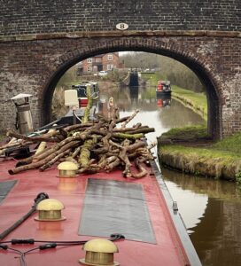
Approaching Minshull Lock (with scavenged wood for stove)

During the 1800s, railway companies gradually bought up many of the canals and the Middlewich Branch was no exception. At one time it was owned by LNWR (London and North Western Railway) and became the site of an experiment to combine the two styles of transport. In 1888, a mechanical engineer had an idea to run a trial with a small locomotive hauling barges along the canal. A one-mile length of narrow-gauge railway track was laid along the canal near to Worleston and an engine was brought up from the Crewe railway works. The tests were successful, with the little engine managing to pull 2, 4 then 8 barges at speeds up to a staggering 7mph. A full report was compiled by a canal engineer, but no further action was taken. One concern could have been that this excessive speed creates a big wake, the wash from the wake would damage the sides of the canals causing them to weaken and fail. Hence the current speed limit of 4mph; we tend to average around 2.8mph or a fast walking pace, it stops the ducks from bobbing up and down too much.

Barbridge junction

And talking about canal banks failing, the most vulnerable stretches to breaching are along embankments where damage caused by water voles can weaken the edges. On 16 March 2018, just outside of Middlewich, a section of the bank, over an aqueduct, failed and collapsed. The 3 million gallons of canal water, that had been between two locks, drained away into the River Wheelock below, leaving 14 narrowboats stranded. It took over 140 lorry loads of “reinforced earth” to replace the 2800 cubic metres of soil. The repair bill was over £3 million and took 9 months to complete (including repairs to a badger set that was discovered on site). What caused this devastation? An investigation concluded that all the paddles on the lock upstream were either opened maliciously or accidentally, and this meant that the canal overflowed. The embankment then failed, creating a tsunami flowing down into the River Wheelock below. 

The embankment is, once again, a lovely spot to moor, but I’m mildly surprised and slightly worried, that they haven’t installed anti-vandal keys on the upstream paddles. I’m just saying, it could so easily happen again!

Fabulous sunsets over the repaired embankment

Salt on your fish?

On the Trent and Mersey heading towards Middlewich

As a youngster, I used to think that salt came from the sea and was very confused to learn that salt was being mined in nearby towns in Cheshire, and had been since Roman times. I wasn’t completely wrong, just 220 million years out of date! The local towns lie on fault lines in the Cheshire plain that hold vast salt deposits from the Triassic period. The Romans were the first to exploit these stores and set up industrial scale extraction for the salt and called these towns Salinae or “the salt workings”. The Saxons continued the practice using ‘Wich’ as their name for salt working. The town, that we are passing through, is between several other towns know as Wichs, such as Nantwich, Northwich and Droitwich, so it was named “Middlewich.

Mackerel skies over Middlewich 


On the map, Middlewich is like a spider, it’s the meeting place for three rivers, three canals and three main roads. During the Roman period there were seven major roads meeting here so they even nicknamed it ‘Medius Vicus’, the town at the junction of the roads.

Kings Lock in Middlewich where three canals meet

By the start of the 20th century the number of industrial salt works in the town declined from over hundred in the 13th century to just nine, with a few of open pan salt works close to the canal. The Grand Trunk Canal, now called the Trent and Mersey, was used to transport the salt up to Liverpool and the rest of the world. A daily canal packet boat also ran up to Manchester and Liverpool to take mail, passengers and freight, returning every night ready for the next run.

During the Middle Ages, the salt mining attracted traders and regular markets were run. Surprisingly, Middlewich has remained quite small and managed to retain its medieval town status, avoiding the invasion of the big supermarkets. The salt industry is still here. During the earlier 20th century, salt was processed and distributed by brand names such as Cerebos and Saxo, but in 1969 British Salt opened a state-of-the-art plant in Middlewich. It now produces approximately 800,000 tonnes (880,000 tons) of pure white table salt every year and, for over sixty years, it has been the premier supplier of salt for the UK, including supermarket own brands. So if you live in the UK, you’ve probably got some salt in your cupboard from under this very town!

British Salt Works, Middlewich
Mountains of salt at British Salt Works, Middlewich


The long-term effect on the land of salt extraction can be seen in the numerous flashes, or lakes, that have appeared in this region. Many have been given status as nature reserves and, due to the salty water, are populated by coastal birds.

It’s a friendly little town and they do like to celebrate their history. The annual Middlewich Folk and Boat Festival takes place in June. It’s been running for over twenty years, and is very colourful, with exhibitions, a funfair, floating boat market, music, dancing and lots of food. 

Whenever we cruise to Middlewich, we know there’s a lovely chip shop just by Kings Lock. It has an excellent reputation that is well known in the boating community, so we always try to time it so we can pop in for an order, but it makes me snigger when they ask if I’d like some salt with that. (I have to wonder if they collected it from the back yard!)

Dramatic dawn and frozen canal near to Wheelock


Heart-break Hill and the local millwright

Red Bull Services at Kidsgrove

We’ve been heading down the flight of Cheshire Locks also known as “Heartbreak Hill”. I’d love to tell you a sad love story of how this nickname came about, but apparently it’s a relatively new name given by leisure boaters due to the sheer never-ending effort of navigating the hill. It stretches 12 miles from Kidsgrove to Middlewich with 31 locks. To speed up progress on the higher section, the original locks were built in pairs, but due to costs, the majority are now singles.


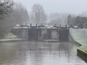
A foggy day at Lawton Locks
Pairs of locks reduced delays


I hadn’t realised how local to the area the chief designer and engineer was. In 1727 at the age of eleven, James Brindley moved to Leek in North Staffordshire, working as a labourer on a farm his father had inherited. He was illiterate and uneducated but had a fascination for machinery, at seventeen he became an apprentice millwright and wheelwright in Sutton, Macclesfield. His new boss thought he was a bit of a bungler but changed his mind after Brindley saved the firm’s reputation by his work on a silk mill in Macclesfield and a papermill at Wildboarclough in the Peak District.

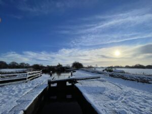
Snowy single locks


At twenty-six Brindley opened his own workshop in Leek and eight years later opened another in Burslem, in a building leased from Josiah Wedgewood. He worked on watermills and windmills and gained a reputation for advising landowners on their machinery. He worked hard and was often paid a wage that was less than a skilled mechanic. He had the appearance of a labourer, but his ideas were revolutionary, and it was the last fourteen years of his life that proved to be his legacy. It was Brindley who had the vision to build a series of canals to link the four main river estuaries, the Mersey, Trent, Thames, and Severn calling it the ‘Grand Cross’. It is understood that he once used a block of Cheshire Cheese to demonstrate his ideas to politicians in a bid to win their approval.

After Brindley had successfully designed and built the Bridgewater Canal, Josiah Wedgewood and his business associates invited him to survey a navigation to join the River Mersey and Trent together. Wedgewood wanted to have a safer route for his Porcelain and Fine Bone China to be exported and an easier route to import the China clay from the West Country. On completion the canal would stretch over 93 miles, have 76 locks and five tunnels.

M6 vs T&M


During his later years, Brindley was hailed as a national hero, especially for triumphing over his poor beginnings. He was employed as the principal engineer on over ten canal systems and consulted on others.


Sadly, his health was poor as he suffered from diabetes and rarely took any rest. In 1772 at the age of fifty-six, he took to his bed. During the night he asked for a glass of water and is believed to have said “That is enough – I shall need no more.” He went back to sleep and died peacefully a few hours later. After his death, his wife tried to call in the monies owed for work that James had completed, but even the Duke of Bridgewater declined to pay up what he owed the family, implying that his needs were greater than theirs!

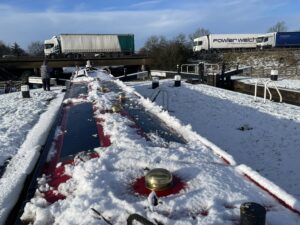
Snowy T&M

It was five years later that the Trent and Mersey Canal was finished. It was described as the “greatest civil engineering work built in Britain.” Although the canal cost £130,000 to build, it reduced the price of transporting Wedgwood’s goods from £2 10s to 13s 4d a ton.

Today, the section we are on is part of the popular Cheshire Ring, a leisure cruising route of 97 miles and 92 locks. If you’re feeling energetic the route can be done in a week. It takes you from the heights of the Peak Forest Canal along the arable plains of Cheshire and into the heart of the city of Manchester. That last part is on the Rochdale canal and passes underneath some of the office buildings, it’s quite a challenge and not for the faint hearted!

Last double locks at Wheelock

We love this canal!

Bridge no 1 at Marple Wharf

We have been cruising – off and on –  along the Macclesfield Canal for over 30 years (I feel old!!). We were both born and brought up next to this canal. Our early years involved many walks along its towpath. When we were in our twenties, we started out as hire boaters. Our 2nd ever boat holiday started in Macclesfield, and was supposed to be the Cheshire Ring, but due to a breech on the Ashton Canal, we ended up doing the Macc and the Four Counties Ring. Boat hire stopped when the children arrived, but we had been bitten by the boating bug. When the kiddies were old enough to swim with life jackets on, we opted to renew our passion for narrow-boating and joined a shared ownership boat scheme which gave us three weeks a year. The first boat was a semi-trad narrowboat called Meridian and then we swapped to one called Ellen. These boats were based at Scholar Green, the first village along from the southern end of the Macclesfield Canal and the base for our family boating holidays. When we got our own boat, Heron, it became our home mooring in 2016 when we moved back to Cheshire. 

Early summer along the Macc (Macclesfield Canal)

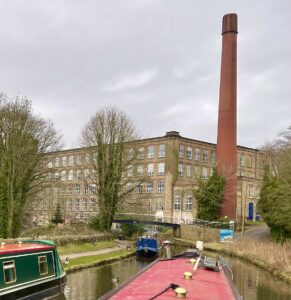
The Macclesfield Canal is a little gem. Designed by Thomas Telford, it’s 36.1 miles stretch between Marple and Stoke-on-Trent, providing a direct canal link between Manchester (Ashton Canal), the Potteries and the Midlands (Trent and Mersey Canal). In its hey day, the Macc provided transport for the cotton and silk mills, quarries and coal mines around Macclesfield, Congleton and the Peak District. Built as a contouring navigation, it follows a set height at two different levels through the countryside, using embankments and cuttings to keep the canal level for as far as possible. There is a flight of twelve locks at Bosley which accommodates the  height change of 118 feet, 36 metres between the 2 levels.

Clarence Mill near to Bollington
Lock 12 at Bosley


All canals need a supply of water especially on the higher summit pound (level) above any locks. Two reservoirs were constructed, at Sutton and Bosley, both have extensive feeder systems stretching back into the hills above the canal. Over the years they have suffered from serious leaks and the Macclesfield Canal Society have worked with CRT (Canal River Trust) to bring them back into production. Which (we hope) will eventually alleviate the water shortages that happen during dry summers.

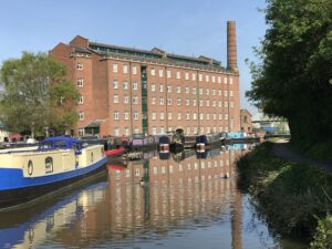
Hovis Mill at Macclesfield Wharf

The Macc took just under five years to build at a cost of £320,000. That was pretty speedy for a new navigation being dug by hand by the Navvies (the workers were called “Navvies” as they were digging a Navigation). It was formally opened in 1831 by processions of boats from each end meeting at Macclesfield Wharf to a gun salute and the sound of “God Save the King” being played by the Band of the Macclesfield Cavalry. The canal proved to be a huge success and created an income of over £6.000 in the first year.

Bridge 77 from Congleton Wharf side
– and  showing curving horse ramp on the other side


The Macc was one of the last canals that Telford designed, and he employed a lot of the solutions to problems encountered on previous canals. Many of its features are now Grade II listed including the five aqueducts (Biddulph Valley, Canal Road, Dane, Poole, Red Bull), all of the locks, the milestones, stone bridges, distance markers and stone fence posts and the entire length is subject to Conservation Area status.

A new style of roving bridge

The first commercial boats were horse drawn and a solution was needed to get a horse on to the opposite side of the canal when the tow path switched sides. These bridges are usually quite a plain pair of ramps that the horse can walk up and over, unfortunately this caused delays as the horse had to be unhitched and retied on the other side. For the Macc, Telford designed a new solution which meant the horses did not have to be untied, these elegant and very clever roving bridges have a ramp on one side and a corkscrew path on the other, they are locally known as Snake, snaily or turn-over bridges.

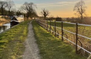
Cast iron railings near to Ramsdell Hall


A striking feature is seen at Ramsdell Hall which overlooks the Cheshire Plain. The owner was refusing permission for the canal to pass in front of the hall as the usual towpath hedge line would block his view. To get the consent of the owner, the Canal Company agreed to provide an open decorative cast iron fence with gates. This unique fence line has now been restored by the Macclesfield Canal Society and continues to provide stunning views. 

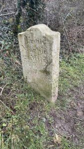
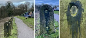
Stone mile posts

During the World War II, as with all road signs, the stone milestones along the length of the canal were buried. In the 1980’s, one of the first projects conducted by the newly formed Macclesfield Canal Society was to dig up and restore these markers. They even named their quarterly magazine after them!

Typical Macc Canal stone fence posts

The original southern end of the canal was at the Hall Green Stop Lock, where the Macclesfield joined the Hall Green Branch of the Trent and Mersey. This branch passes over the Red Bull Aqueduct above the A50 and then the Poole Aqueduct over the the Trent and Mersey mainline(it’s quite confusing on the map too), before taking a 90 degree turn to eventually join the mainline at Hardings Wood Junction. Hall Green Stop lock was where the two canals joined.

Hall Green (image credit Macclesfield Canal Society)

Canal companies were fiercely competitive, which explains why the lock was originally twice as long and had 3 sets of gates. This made 2 locks, one controlled by the Macclesfield Canal Company and one by the Trent and Mersey, and that’s why there are 2 lock-keepers cottages. The stone one for the Macclesfield and the rendered brick one for the Trent and Mersey. There are no lock-keepers now, the lock has been shortened and the Hall Green Branch is now treated as part of the Macc.

Boats at Macclesfield Wharf Marina

Macclesfield’s name was derived from the Old English name, Maccel, and field, yielding the meaning “Maccel’s open country”. The town is famous for its once thriving silk industry and was nicknamed “Silk Town” but strangely it has a second nickname of “Treacle Town”. This refers to a centuries-old accident when a horse-drawn wagon overturned, spilling its cargo of treacle onto the cobbles. The monthly Treacle Market is inspired from this and is well worth a visit https://www.treaclemarket.co.uk .

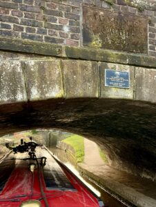
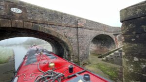
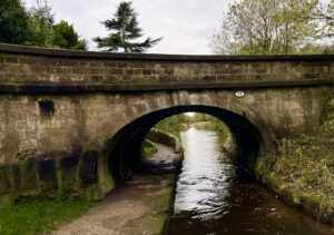
Having travelled the canal for many years now, I was quite surprised to spot something unexpected under one of the bridges. I sometimes look for a stone mason’s mark, (like a cross or triangle) these were used to ensure they got paid for the blocks that bore their mark, but this was carved in 1829, whilst the canal was still being built!

Carved name; is it graffiti?