Just a pretty picture?

My attempt at a crafty canal art vase

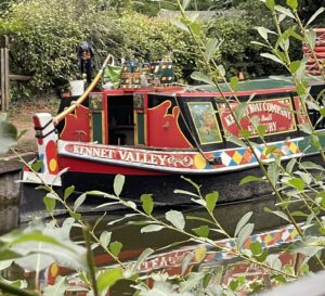
Bit of a colourful one this week. Ian keeps buying me flowers and I don’t have a vase, so I decided to get crafty and upcycle a large instant coffee jar by painting it in a traditional canal style called “Roses & Castles” (Yes, I know I’ve missed off the castle!).
This got me thinking about where this style of art came from and if it reveals anything to do with the heritage and origins of the first English bargees and boatmen back in the late 1700s.
 

Horse Trip Boat at Hungerford

The theories on the origins of this “chocolate box style” of painting are varied. The first idea I found was that the moniker of water-gypsy was given to boatmen as a nod to them previously being Irish travellers or Romany gypsies, but there is no evidence for this.

Example of Dutch style of Hindeloopen art

The style of this artwork does have similarities to traveller culture and folk art from Germany, Holland, Turkey and even Bangladesh. The Dutch art style of Hindeloopen is a perfect example and illustrates how flowers are depicted with simple brush strokes. Unfortunately, as the influence of this style is so widespread across Europe (and Asia), it doesn’t provide any concrete evidence for a specific group or ethnicity of people being the original bargees or boatmen.

The Roses & Castles style didn’t start to appear on boats until the 1830s. This coincided with a period when the competition from the railways increased causing a cost of living crisis for the boaters. Up to then, the boats had been run by one man with a boy employed to lead the horse. The boatman’s family would live in a house on land. Now they couldn’t afford to maintain a family home, so their families had to travel with them as unpaid labour. It was at this time that everything became decorated with these colourful designs, from the horse’s harness to the drinking cans, cupboard doors and the butty rudder. But it’s a myth that there’s only roses and castles. The designs feature any flower, river, building or animal that the boater liked the look of.

A table flap from collection at the Boat Museum, Ellesmere Port
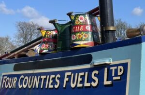
Painted water cans usually have the boat’s name 

The one thing that the historians of the Roses & Castles style do agree on is the purpose of this bold show of colour and painted extravagance. During the industrial revolution there was a negative attitude towards the bargees and their families from the land people. They were chastised as being dirty and illiterate. So, although many boats were owned by canal carrying companies and had to show the colours of their livery, the families that lived on them kept the cabins spick and span. The brass work was polished, delicate lace curtains and pretty China plates were hung and bright, romantic, rich-coloured pictures adorned panels and buckets. The whole boat was an exhibition to the grimy world that they travelled through, a bold statement of their pride in themselves and their community.

The battle to show their worth didn’t just stop with decorating the boats and horses. During the Victorian period, the boat people gradually evolved their own style of dressing, that marked them as a recognisable trade. The men had bright neck scarves and corduroy trousers, the women wore long white aprons and pleated bonnets. A trade uniform that, despite the hardships of their work, identified them as an elite and proud society.
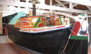
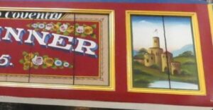
Boat displayed at The Boat Museum, Ellesmere Port


Boat display at The Boat Museum, Ellesmere Port

I did find one suggestion that made me wonder about how innocently myths start. Apparently, there was a gardener who lived near to the Llangollen Canal at Chirk. His garden had a beautiful array of flowers that framed a view of Chirk Castle and that is said to have inspired the first panel of Roses & Castles to be painted. It must have been an impressive display. And as to the earliest bargees and boatmen, they weren’t on England’s canals or in the 1700s. The first recorded bargees were Egyptian in about 2,400BC! 
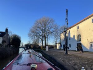
 

Heart-break Hill and the local millwright

Red Bull Services at Kidsgrove

We’ve been heading down the flight of Cheshire Locks also known as “Heartbreak Hill”. I’d love to tell you a sad love story of how this nickname came about, but apparently it’s a relatively new name given by leisure boaters due to the sheer never-ending effort of navigating the hill. It stretches 12 miles from Kidsgrove to Middlewich with 31 locks. To speed up progress on the higher section, the original locks were built in pairs, but due to costs, the majority are now singles.


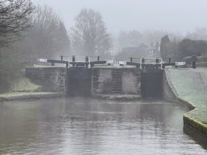
A foggy day at Lawton Locks
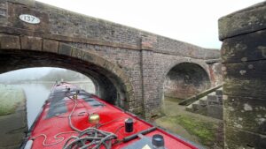
Pairs of locks reduced delays


I hadn’t realised how local to the area the chief designer and engineer was. In 1727 at the age of eleven, James Brindley moved to Leek in North Staffordshire, working as a labourer on a farm his father had inherited. He was illiterate and uneducated but had a fascination for machinery, at seventeen he became an apprentice millwright and wheelwright in Sutton, Macclesfield. His new boss thought he was a bit of a bungler but changed his mind after Brindley saved the firm’s reputation by his work on a silk mill in Macclesfield and a papermill at Wildboarclough in the Peak District.

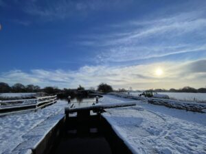
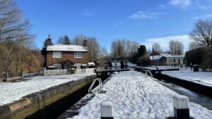
Snowy single locks


At twenty-six Brindley opened his own workshop in Leek and eight years later opened another in Burslem, in a building leased from Josiah Wedgewood. He worked on watermills and windmills and gained a reputation for advising landowners on their machinery. He worked hard and was often paid a wage that was less than a skilled mechanic. He had the appearance of a labourer, but his ideas were revolutionary, and it was the last fourteen years of his life that proved to be his legacy. It was Brindley who had the vision to build a series of canals to link the four main river estuaries, the Mersey, Trent, Thames, and Severn calling it the ‘Grand Cross’. It is understood that he once used a block of Cheshire Cheese to demonstrate his ideas to politicians in a bid to win their approval.

After Brindley had successfully designed and built the Bridgewater Canal, Josiah Wedgewood and his business associates invited him to survey a navigation to join the River Mersey and Trent together. Wedgewood wanted to have a safer route for his Porcelain and Fine Bone China to be exported and an easier route to import the China clay from the West Country. On completion the canal would stretch over 93 miles, have 76 locks and five tunnels.

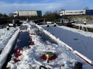
M6 vs T&M


During his later years, Brindley was hailed as a national hero, especially for triumphing over his poor beginnings. He was employed as the principal engineer on over ten canal systems and consulted on others.


Sadly, his health was poor as he suffered from diabetes and rarely took any rest. In 1772 at the age of fifty-six, he took to his bed. During the night he asked for a glass of water and is believed to have said “That is enough – I shall need no more.” He went back to sleep and died peacefully a few hours later. After his death, his wife tried to call in the monies owed for work that James had completed, but even the Duke of Bridgewater declined to pay up what he owed the family, implying that his needs were greater than theirs!

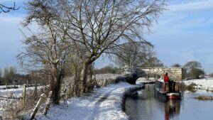
Snowy T&M

It was five years later that the Trent and Mersey Canal was finished. It was described as the “greatest civil engineering work built in Britain.” Although the canal cost £130,000 to build, it reduced the price of transporting Wedgwood’s goods from £2 10s to 13s 4d a ton.

Today, the section we are on is part of the popular Cheshire Ring, a leisure cruising route of 97 miles and 92 locks. If you’re feeling energetic the route can be done in a week. It takes you from the heights of the Peak Forest Canal along the arable plains of Cheshire and into the heart of the city of Manchester. That last part is on the Rochdale canal and passes underneath some of the office buildings, it’s quite a challenge and not for the faint hearted!

Last double locks at Wheelock

“That must be painful”

“Aren’t they cold?”


“Are you on a pilgrimage?”

“You’re a proper boatman!”

“Why…”

I’ve heard all these comments and more this year – the last one from Heather. This is the story of how I accidentally became a barefoot walker.

No shoes on board

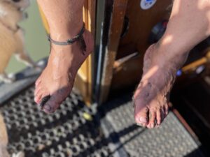
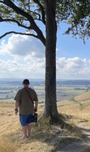
Living on the water for a long, dry summer probably helped. I’d stopped wearing anything on my feet inside the boat a few years ago. To make it easy, I had taken to slipping on flip flops when getting off the boat for locks or other boat related tasks. But flip flops can get in the way when climbing over lock gates or they fall off or slip at just the wrong moment, so I often took them off and went barefoot. Eventually, I stopped bothering with them at all.

As I started to spend more time barefoot and walk greater distances, I did notice that my feet, ankles and calves were getting much more of a workout and they let me know about it too! But they were also getting stronger, and the soles of my feet were becoming tougher. At the same time, I realised I was getting much less lower back and knee pain. I began going barefoot on longer walks, even hiking in the hills. I had unintentionally become a barefoot walker.

Little children run around in bare feet. But, as we get older, we are told to wear ever more supportive and restrictive footwear. Even though barefoot felt right, I wondered if going barefoot was wrong. So, I took to Google – and quickly discovered that there is a whole community of people out there who are going barefoot. There’s research that shows that many of the benefits I experienced are real. It shouldn’t be a surprise, take a step back and consider the fact that we evolved to walk bare foot. If you transition to barefoot walking gradually, your feet, ankles and legs can revert to working the way they were designed to. Your arches will return, your feet will become more supple, your ankles will strengthen. Your calf muscles, which have been shortened by years of raised and cushioned heels, will stretch to their natural length. The strain on your knees reduces as your whole foot acts more like the shock absorber it is supposed to be.

There are some purists who shun any form of footwear. That’s too extreme for me, but what can you do if you need to wear something on your feet, but “normal” footwear now feels too uncomfortable? This could be In urban settings where there is a greater risk of injury (or dog poop!), or when it gets too cold or wet? Even the most toughened feet don’t have much grip in the wet and it’s not much fun if they go numb because of the cold.

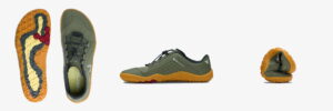
Barefoot shoes

Well, there are a growing number of businesses that make barefoot shoes. Sounds like a contradiction but they give many of the benefits of being barefoot, but in shoes. Key features of barefoot shoes are a wide toebox, a zero drop heel, thin soles and flexibility.

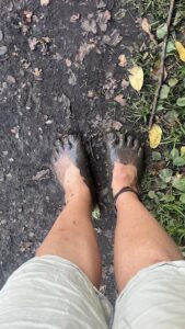
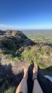
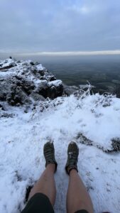
Going barefoot means you are more in touch with your environment. Some advise that it is good for your mental health. You are certainly healthier and more aware of the changing seasons and temperature of the ground. You even notice more about the vegetation around you – especially if there’s brambles or hawthorn!

Mid November

Same spot – mid December

The world’s greatest treasure hunt

Geocaching.com
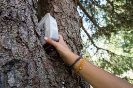
Hiding places in trees

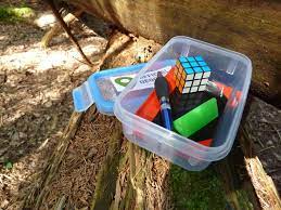
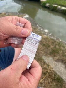
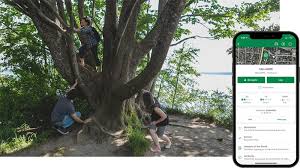
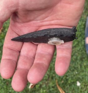
Some years ago, we had a young family (yes, they are now all grown up and in their twenties!) who hated walking very far, that’s when we discovered geocaching, the greatest global never ending treasure hunt https://www.geocaching.com/play . The caches or treasure boxes are hidden everywhere around the planet and range in size from a micro, approximately the size of a size C battery, to a traditional cache, which range in size from a small sandwich box to an ammo case. Each cache is waterproof and usually contains a logbook and, if it’s large enough, a pen or pencil. It may also hold toys or keepsakes that can be traded. I remember doing some geocaching with a troop of scouts on the south coast and discovered souvenirs that had been added by the local tourist board.

Typical traditional sized geocache
Logbook found in microcache

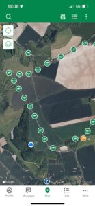
It’s suitable for all ages and free, as you can sign up without a subscription, but more caches are shown if you subscribe. Geocches are created by other geocachers and they are hidden everywhere, in towns, by the seaside, in parks and the countryside. You use a mapping app which is for either Apple or Android. The app uses GPS to show your location and nearby geocaches on a map. This gets you to within approximately 2 metres, it’ll tell you the size of the cache and you can look at a hint or clue to help locate it.

The phone app shows you locations and hints

The idea for the game was born on May 3rd 2000, the day after the US Government removed “Selective Availability” for Global Positioning Systems with a statement from the White House that anyone could “precisely pinpoint their location or the location of items (such as a game) left behind for later recovery.”

A GPS enthusiast in Oregan called Dave Ulmer wanted to test the accuracy by hiding a navigational target in the woods near his home in Beavercreek. He called the idea the “Great American GPS Stash Hunt” and posted it in an internet GPS users’ group. The idea was simple: Hide a container out in the woods and note the coordinates with a GPS unit. The finder would then have to locate the container with only the use of his or her GPS receiver. The rules for the finder were simple: “Take some stuff, leave some stuff.”

But be warned, the secrecy of keeping the cache hidden is paramount. Muggles (non-geocaching people) must not be allowed to see what you are doing; witness what you have found or see you replace the cache for fear that they may tamper with it and spoil the game.

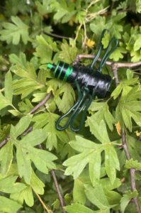
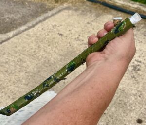
We’ve found some very sneaky geocaches, they were camouflaged as a stick, a slug and a twig! The slug was magnetic and stuck to the underside of a metal park bench.

Slug microcache
Insect microcache
Stick microcache

By the way, if you do give this a go, be prepared to be surprised by the number of geocaches hidden near to you. There are 67 hidden within a mile of the Town Hall in Manchester, 84 hidden within a mile of Edinburgh Castle.
My sister lives in New Zealand and was shocked to discover that there were over 2,000 geocaches within a 5km radius of her home. And be warned – there are even some caches classed as nano, literally the size of a small coin and probably magnetic. 

Good luck and have fun – but watch out for those muggles!

Where are we? Finding our way

Near to Banbury on the Oxford Canal

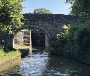
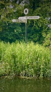
“Where are we?” That might sound daft, but it’s a legitimate question when most of the canal and river system looks like a watery green corridor! Thankfully every bridge and lock have names and numbers and junctions usually have signposts.

Near to Wormleighton on the Oxford Canal


But when there’s nothing but greenery, it’s often a sense of smell that helps! Such as if you smell coffee, you’re close to Banbury, if it’s beer then it’s Burton-upon-Trent and if it’s the gentle aroma of sewage, then there’s a sewage works nearby! You can sometimes smell as well as hear a big weir as the moist air often hangs along the river. You also get more cyclists and walkers on the towpath and bridges as you get closer to a town.

Pigeon Bridge on the Oxford Canal
Junction of Duke’s Cut and River Thames


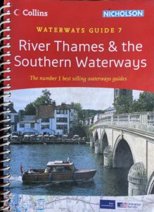
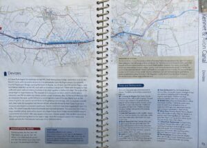
Do you remember Wainwright’s walking books? We have a similar descriptive series of waterway guidebooks commonly known as the Nicholson guides. They aren’t as beautifully illustrated, but they do explain the lay of the land, a bit of the history and give advice on hazards such as tidal waters or time restrictions for lift bridges. The reviews of pubs and towns can really help with meal planning and stocking the larder. Other essentials include the location of the next water tap, rubbish disposal and yes, an Elsan point, to empty the cassette toilet (yuck). If you’ve owned a caravan or motorhome, you’ll know all about keeping topped up and cleaned out!

Nicholson Guidebook
Nicholson Guide- Caen Hill and Devizes on the K & A
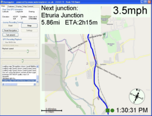
Navvygator application-showing Etruria on the Trent and Mersey Canal, Stoke-on-Trent

This all sounds very basic, so where’s the technology? If Ian’s involved there has to be some somewhere and you’d be right. There are various apps on the iPhone with route planning on them, such as Open Canal Map and Canals UK. We often use Google maps in satellite mode to assess ahead for mooring opportunities, as you can spot the landing stages, designated visitor moorings and even where other people have managed to moor in the past. This can be really useful on rivers where it’s not that easy to moor just anywhere. We also have a GPS tracker that’s plugged into an old Windows tablet with a free mapping application called Navvygator. It plots our route in real-time. It also estimates distances and travel time to the next lock, swing bridge, winding hole (turning space) or junction (available free from http://waterexplorer.co.uk/Brochure/Navvygator.aspx). GPS takes the guess work out of finding where we are, but as you will know, even that can be unreliable in certain situations.

The What3Words app is also used quite widely on the system. If we spot a problem like a broken paddle on a lock (the thing that allows you to control water flow) or a fallen tree, we can send a notification to the Canal & Rivers Trust and give the location using What3Words app. It’s also essential in case we have to call for the emergency services, as they wouldn’t have a “scooby do” about being south of a bridge called Ladydown on the Kennet and Avon Canal!

We don’t often get lost, but on some stretches, particularly in a cutting where the canal is running along a deep “valley” and we lose GPS, we do have to wait for the next bridge to check the number on it!